The idea behind this walk is that we’re going to start off at Victoria Station and then trek in a straight line for five miles, all the way north to Primrose Hill. And then we’re going to plant our flag at the summit and clam it for the Queen. So you need to think of it as an expedition. You have to pretend that we’re Arctic explorers. It’s probably freezing cold today (it usually is in London), so wrap up warm. And take a camping stove and some Kendal Mint Cake with you in case you get lost. If you can get hold of a harpoon as well then that will be fantastic (in case we have to kill any polar bears). And take a knife as well, in case we get involved in some hand-to-hand combat with some penguins.
Who was that famous British explorer who went to the South Pole in 1912? Was it Captain Scott? Let’s pretend that we’re him! Obviously I will play the role of Captain Scott (because I’m the captain) and you can be one of his useless sidekicks. Don’t worry about that bit at the end where they all died of hyperthermia – if it gets too cold then we’ll just catch a bus back home.
Victoria Station is a great place to start because you can have a coffee on the concourse and then find Buckingham Palace Road (look for the Shakespeare pub on the corner). Then turn right into Queen Victoria Street. You will almost certainly mess this first bit up because I always do. I still can’t tell these roads apart even after twenty years. So that doesn’t bode well, does it – getting lost on the very first corner! But we’re Arctic explorers, remember, and explorers are allowed to get lost. If somebody asks us if we’re lost then we’ll just say no, we’re exploring.
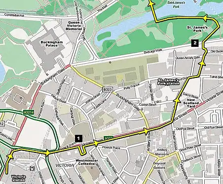
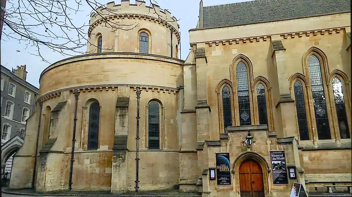
Queen Victoria Street is the one with thunderous buses and vans and taxis coming down it, past big buildings made of glass. This is modern architecture hell. But if you keep a look out to your right then you’ll see one of the most surprising exteriors of all – the Byzantine splendour that is Westminster Cathedral [see 1 on the map]. I always think it needs a Turkish Sultan living in it, but it’s full of dark, sooty stone and coloured marble inside. Have a quick pop inside and take a look. If it’s as cold for you as it is for me today, then you can go and warm your hands on a candle.
There really are some ugly buildings down Queen Victoria Street… I’d forgotten just how bad they were. But thankfully when you get to Buckingham Gate it will start to pretty up a bit. That’s when you’ll realise how nice the road could have been before we turned it over to the architects. There are lots of government buildings down Queen Victoria Street, and I often wonder whether this would have been the ultimate fate of Whitehall if it had been bombed during the war. Thank Christ it wasn’t!
Turn left when you get to Broadway, walk past the spinning New Scotland Yard sign, and look towards the right after you pass St. James’s Park station. You should see a thin slither of Westminster Abbey up ahead. Don’t go all the way towards it, though, because we need to take a quick left into Dartmouth Street and then head down the Cockpit Steps (it’s a little entrance at the end of the street). When you come out of the other side you should be staring at the green trees of St. James’s Park [see 2 on the map]. Hopefully the sun will be shining now.
Have a stroll along the lake whilst avoiding all of the ducks (I hate ducks), and then cross over the bridge in the middle. When you get halfway across get your camera out and take a photo of Buckingham Palace, and then spin around and snap one of Horse Guards as well. Keep going in a straight line until you hit the Mall, and then turn left towards Buckingham Palace. That brown brick building over the road is St. James’s Palace (behind that brown brick wall with black fencing on top), and the creamy white one next-door is Clarence House, where Prince Charles lives with his chain-smoking missus.
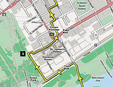
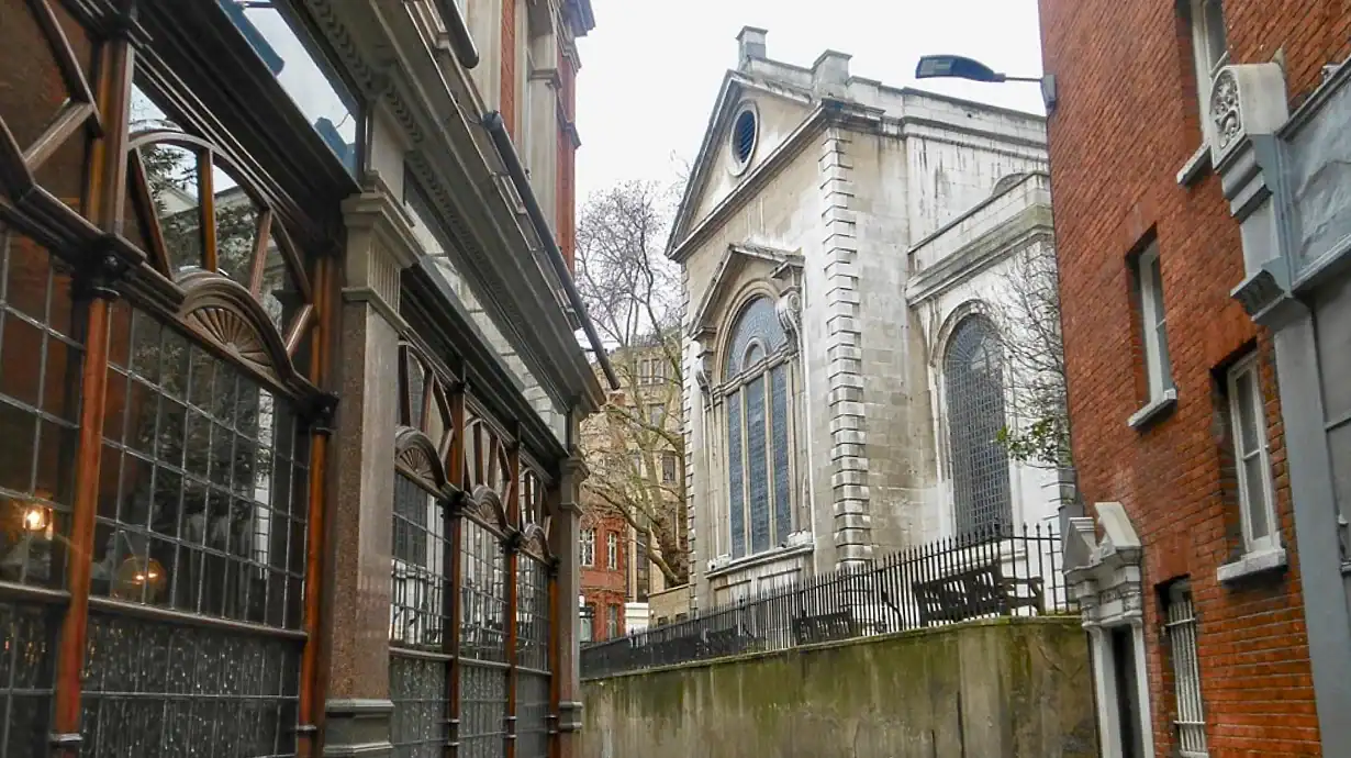
You’re going to like this next section because it’s quite interesting – not many people venture down here. What you need to do is turn right into Green Park, and then walk along the pathway that runs up the eastern edge. Keep an eye out for a little alleyway on the right, through some black railings. It’s not very obvious, so you need to keep your peepers peeled [see 3 on the map].
You’ll find some very fine buildings at the other end of the alley, and also the front face of St. James’s Palace. This is Pall Mall. This is where you’ll find all the posh gentleman’s clubs (the kind of clubs that they’d never let us into). This is also where the fictitious Phileas Fogg set off on his journey around the world.
Keep another eye out for the beautiful little Crown Passage on the left – a very pretty little lane full of wooden shopfronts and Dickensian lamplights. Then cross into the super-posh Bury Street, and turn right down Ryder Street. If only the whole of London looked like this!
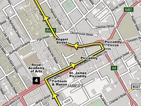
Now you need to turn left till you reach Piccadilly, and then walk up to Piccadilly Circus on the right [see 4 on the map]. Then I think I’ll let you have a sit down, because you must be knackered by now (I know I am). There are plenty of coffee shops along Piccadilly if you fancy having a stop.
So what do you think of the walk so far? That last little stretch through St. James’s was pretty special, wasn’t it?
I’m totally knackered now, so I’m going to have to walk a little bit slower – sorry about that. I hope you don’t mind. Can you do me a favour and just slow your pace down a little bit? Because I’ve only got little legs and I’m a lot older than you, remember. And we haven’t even climbed up Primrose hill yet! You might have to carry me up on your back when we get there. Did you remember to bring the flag?

This next section is pretty easy, because we’re just going to follow the line of Regent Street all the way up to Regent’s Park. It starts off at Piccadilly Circus and then keeps going and going and going until we hit the Marylebone Road.
There’s not much that I can say about Regent Street, other than it’s full of posh shops like Calvin Klein, Karl Lagerfeld and Tommy Hilfiger. It also has some chain stores like H&M, Jaegar and Boss. But seeing as I make all my own clothes out of dustbin bags and blankets, they don’t interest me. I’m much more interested in Hamley’s toy store, because that’s where I buy all my teddy bears.
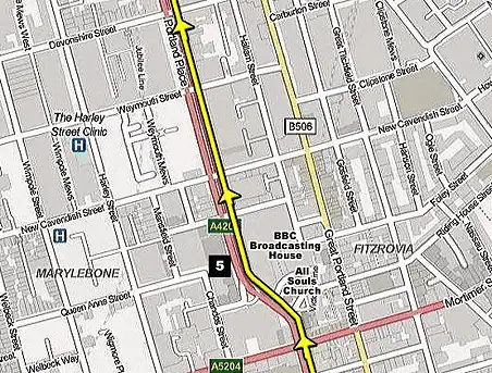
When you get to the conical top of All Souls’ Church take a quick look at the BBC’s HQ on the other side [see 5 on the map]. You sometimes see this shot of it on the evening news, and if you’re lucky then you might even see somebody famous walking out of the front door.
The most famous person that I ever saw down here was La-La from the Teletubbies. I excitedly asked her for her autograph, but she just pushed me into a puddle and skipped off laughing. So I ripped off her antennas and chucked her handbag in a skip (and that is true).
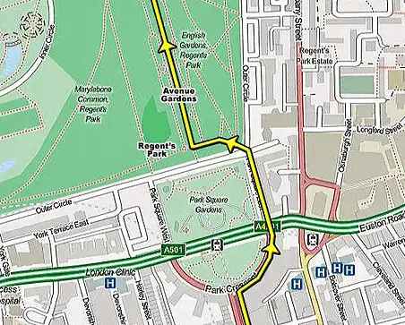
Carry on in the same direction (the road will morph into Portland Place), until you get to the end. Then follow the curve around to the right until you enter Regent’s Park.
You might want to check out the park map for this bit, because we want to get into Avenue Gardens, and then follow it all the way up to the corner of London Zoo (the map is on a big information board by the entrance). I’ll warn you right now that’s it’s a long way. In fact, it’s a very long way. I haven’t measured it, but I’m guessing that’s it’s about six thousand miles away (at least), so crack open that packet of Kendal Mint Cake to keep your energy up.

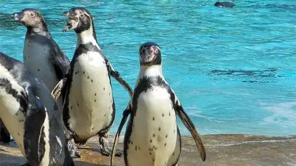
When you get to the big pointy monument in the middle of the path, STOP! [see 6 on the map] You’re going to like this next bit – I promise. This is where our North Pole expedition actually turns a bit arctic. I bet you thought I was joking when I said that we might meet some penguins, but if you carry on walking a bit further on (in the same direction), then you should be able to see some penguins through the railings – I’m being serious!
I won’t tell you exactly where they are – I’ll let you hunt them down like a real arctic explorer. It’s pretty obvious when you spot them, because there’s a big blue pond of water.
Now you need to turn back round and return to that pointy monument again, and then head right along the side of London Zoo [see 6 on the map]. You’ll get a decent look at some more creatures along here – especially the camels. I bet you didn’t expect to see some camels at the North Pole! If you’re lucky then you might even be able to see some tigers (although they’ll have to be sitting in the correct spot). That big desert range at the end of the zoo looks quite exciting, but it’s actually full of emus and wallabies, which are very hard to see.

When you get to the end of the zoo turn right, out of the park, and go over the road and across the canal bridge. That big wire cage down the canal is the Snowden Aviary, which is home to lots of tropical birds (and sparrows and pigeons, which fly in through the netting).
Cross over the next road and you will see another park straight ahead. This is the North Pole – we are nearly there! You’ll see Primrose Hill rising up from the centre of it. That is where we need to stick our flag (unless some pesky Norwegians have beaten us to it). Your compass should be going haywire at this point.
Now… I freely admit that Primrose Hill does not look like a mountain the first time you clap eyes on it, but you need to trust me. Once we’ve struggled to the summit then the view will definitely be worth it. And struggle we will, because it’s a hell of a lot steeper than it looks. Come to think of it… I should really have done this walk the other way round, and climbed up this hill at the beginning, because it’s a bit sadistic of me making you climb it at the end, but… ah well. It’s too late to worry about that now. If you die, you die – it’s not my problem.
Did you remember to bring the flag? Otherwise you’re going to have to walk all the way back home and get it, and start all over again.
The view from the top is far better than you’d expect. Let’s have a little competition to see how many London landmarks you can spot. If you can’t see the Shard straight away then you definitely need to buy some new glasses. St. Paul’s and the London Eye are extremely easy, whilst the Gherkin and Canary Wharf are a little bit harder. But what about the top of Big Ben and the Tate Modern? And if you can pick out the ArcelorMittal Orbit by the old Olympic Park then you’re a genius.
So that’s the end of the walk! I hope you enjoyed it. I’m going to desert you at the top of the hill now. If you want to get back home then you need to head down the lefthand slope (the lefthand one, if you’re standing there looking at the skyline), and then turn left up Regent’s Park Road to Chalk Farm tube station. You can catch some buses or a tube train back into town from there.
 London Squire guidebook – Check out my guidebook available to buy at Amazon, Apple and Kobo. I’ve spent the last twenty years visiting London’s landmarks, attractions and hotels and collected all of my reviews, example itineraries, advice about using the buses and trains, and handy practical info into an eBook, along with 650 original photographs


Your comments
What do you think? Share your thoughts
Be the first to talk about this
Be the first to comment (no need to register)
Save money on attractions Discount passes at Get Your Guide Check out the London Pass, London Explorer Pass, Discovery Pass, Golden Pass and attraction combo tickets · 24/7 multi-lingual customer support